

Mapping Paris 1889-1934
The Cartographic Capital: Mapping Third Republic Paris, 1889-1934.
Kory Olson, Liverpool UP, 2018. 320 pp. Maps, notes, bibliography, index
Kory Olson is Associate Professor of French at Stockton University
Review by Catherine Dunlop, Montana State University.
H-France Review Vol. 19 (January 2019), No. 20
http://h-france.net/vol19reviews/vol19no20dunlop.pdf
http://h-france.net/h-france-review/
Creating Republican Paris
1 Working with Maps
2 Creating Map Readers: The Rise of Geography and Cartography in Nineteenth-Century France
3 The Triumphant Republic: ‘Paris en 1889, les opérations de voirie exécutées entre 1871 et 1889’
4 A New Way of Seeing Paris: The Service Géographique’s Carte de France
130 5 The Beginning of French Urbanism: Léon Jaussely’s 1919 Plan d’extension
175 6 The Rise of Suburban Paris: Henri Prost’s Carte générale
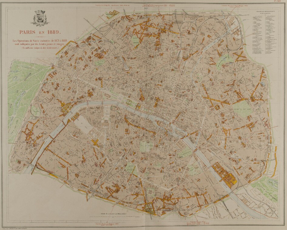
Alphand, Paris en 1889, Les opérations de voirie exécutées de 1871 à 1889
(avec cartes de Paris en 1789, et de Paris en 1854)
Jaussely, Expert, and Sellier, ‘Projet lauréat de la section générale du concours du plan d’extension de Paris’ (Plan d’extension), 1919
Les prémices d’un Grand Paris – Le concours pour le Plan d’aménagement, d’embellissement et d’extension de 1919
par Beatriz Fernández Águeda
http://www.inventerlegrandparis.fr/
Prost, Henri, ‘Carte générale de l’aménagement de la Région parisienne, région sud,’ 1934
http://tinyurl.com/yx9q93aw
.


/http%3A%2F%2Fstorage.canalblog.com%2F95%2F55%2F161889%2F106114070_o.jpg)
/http%3A%2F%2Fstorage.canalblog.com%2F32%2F54%2F161889%2F105869631_o.jpg)
/http%3A%2F%2Fstorage.canalblog.com%2F17%2F34%2F161889%2F97636970_o.jpg)
/http%3A%2F%2Fstorage.canalblog.com%2F18%2F01%2F161889%2F78317311_o.jpg)
/https%3A%2F%2Fstorage.canalblog.com%2F02%2F17%2F161889%2F117651881_o.jpg)
/https%3A%2F%2Fstorage.canalblog.com%2F19%2F63%2F161889%2F117610470_o.jpg)