

Cartographic Japan
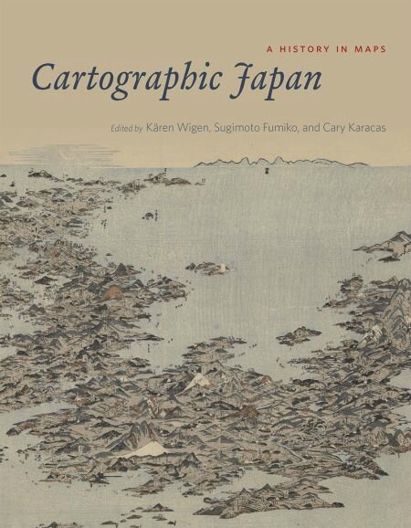
- Cartographic Japan A History in Maps (source Twitter JCF)
Kären Wigen, a geographer and historian at Stanford
Sugimoto Fumiko, a historian at the University of Tokyo
and Cary Karacas, a geographer at the College of Staten Island
+ 47 contributors. University of Chicago Press 16.03.2016
(20 pages , dont le sommaire, à consuter sur Google Books)
http://lareviewofbooks.org/article/putting-japan-map/
I - Visualizing the Realm : XVI to XVIIIth Century
Japan in the world
Domestic space
II - Public Places, Sacred Space
Mapping the city
Sacred sites and cosmic visions
Travelscapes
III - Modern Maps for Imperial Japan
defining the borders
transforming the landscape
managing an Empire
IV - Still under construction : Cartography and Technology since 1945
up from ashes
growing pains in a global metropolis
new directions in the Digital Age
extraits :
« Cartographic Japan is divided into four parts. The first section, covering the 16th through 18th centuries, explores the rise of a “robust cartographic culture” ranging from small maps of villages by and for local elites to massive artworks that found their way to European markets ».
Part II of the collection is largely concerned with the 18th- and 19th-century rise of commercial cartography
In Part III, attention shifts to the proliferation of maps chronicling Japan’s urbanization, industrialization, militarization, and expansion from the mid-19th century through the end of World War II
The final part of the collection is devoted to mapping after 1945 — an understudied era
The newly salient phenomenon of citizen mapping in the wake of earthquake and tsunami of March 11, 2011 »
http://lareviewofbooks.org/article/putting-japan-map/
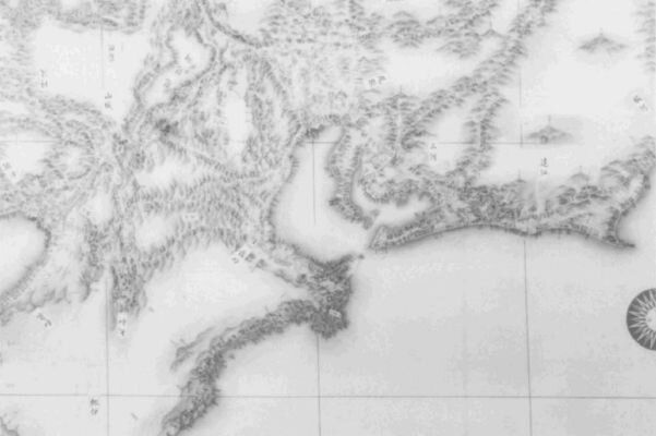
Nagoya 1821
- Cartography in Japan
Unno Kazutaka, chap 11
http://clioweb.canalblog.com/archives/2016/08/20/34210524.html
in
History of Cartography, John Brian Harley & David Woodward,U Chicago Press 1994
http://clioweb.canalblog.com/archives/2016/08/20/34210502.html
+ chap 14,
Japanese Celestial Cartography before the Meiji Period, Kazuhiko Miyajima
- Japoniæ insulæ, The mapping of Japan: Historical Introduction and Cartobibliograhy of European Printed Maps of Japan to 1800
by Jason C. Hubbard 2012 - 444 pages with 374 colour illustrations
Review by Sir Hugh Cortazzi
http://www.japansociety.org.uk/28167/japoniae-insulae/
- History of maps in Japan - Wikipedia
http://en.wikipedia.org/wiki/Japanese_maps
Old maps of Japan
http://commons.wikimedia.org/wiki/Category:Old_maps_of_Japan
Historical Maps of Japan
http://www.edmaps.com/html/japan.html
Japanese Historical Map Collection contains about 2,300 early maps of Japan and the World. Berkeley
http://www.davidrumsey.com/japan/
Old maps online, Japan
http://www.oldmapsonline.org/en/Japan
The Map Room
Map found of famous fortress that vexed shogun Ieyasu (1542-1616)
By Shinya Okudaira July 13, 2016
http://www.asahi.com/ajw/articles/AJ201607130043.html
The map of the Sanada Maru fortress believed to have been drawn around 1690 has been found in Matsue.
On the web, the diagram is rotated 180 degrees to have the north face upward. (Provided by the Matsue History Museum)

Himeji castle, 1761 map
http://commons.wikimedia.org/wiki/File:Old_map_of_Himeji_castle.jpg
.


/http%3A%2F%2Fstorage.canalblog.com%2F20%2F53%2F161889%2F130761795_o.jpg)
/http%3A%2F%2Fstorage.canalblog.com%2F15%2F39%2F161889%2F127646645_o.jpg)
/https%3A%2F%2Fassets.over-blog.com%2Ft%2Fcedistic%2Fcamera.png)
/http%3A%2F%2Fstorage.canalblog.com%2F79%2F71%2F161889%2F126742218_o.jpg)
/https%3A%2F%2Fstorage.canalblog.com%2F02%2F17%2F161889%2F117651881_o.jpg)
/https%3A%2F%2Fstorage.canalblog.com%2F19%2F63%2F161889%2F117610470_o.jpg)