

6 avril 2019
USA 1856 : Free and Slave states
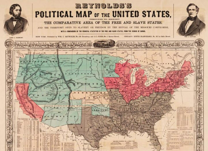
Reynolds's Political Map of the United States
Designed to Exhibit the Comparative Area of the Free and Slave States
Reynolds, William C.1856
Persuasive Maps: PJ Mode Collection
avec analyse et commentaire
http://digital.library.cornell.edu/catalog/ss:19343476
rappel : http://clioweb.canalblog.com/tag/persuasive
Persusive Maps, Cornell Library http://persuasivemaps.library.cornell.edu/
Publicité


/http%3A%2F%2Fstorage.canalblog.com%2F64%2F24%2F161889%2F125085248_o.jpg)
/http%3A%2F%2Fstorage.canalblog.com%2F66%2F10%2F161889%2F125087194_o.jpg)
/http%3A%2F%2Fstorage.canalblog.com%2F48%2F52%2F161889%2F124964813_o.jpg)
/http%3A%2F%2Fstorage.canalblog.com%2F97%2F12%2F161889%2F124644507_o.jpg)
Commentaires
/https%3A%2F%2Fstorage.canalblog.com%2F02%2F17%2F161889%2F117651881_o.jpg)
/https%3A%2F%2Fstorage.canalblog.com%2F19%2F63%2F161889%2F117610470_o.jpg)