

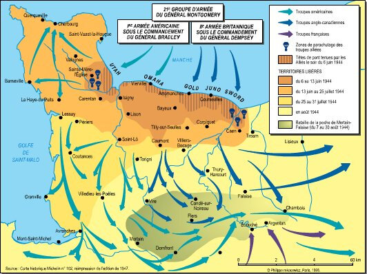
1944 - La bataille de Normandie
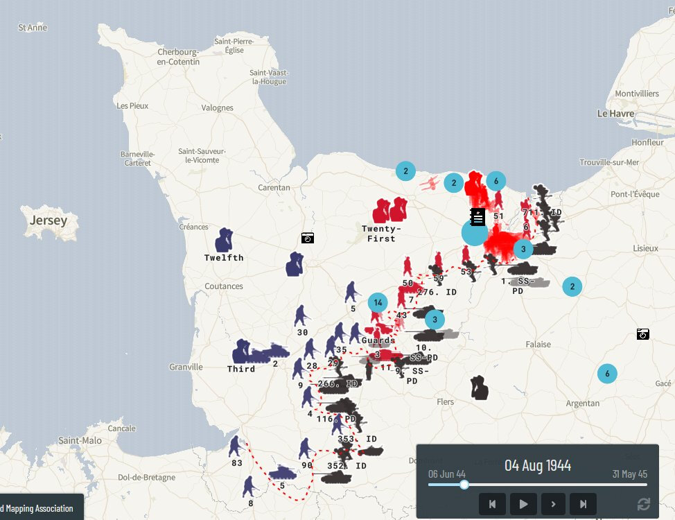
The data is a collection of 70,000 points of data mapped by the Project '44 team.
(USA : bleu foncé, rouge UK, noir Allemands)
cercles bleus avec chiffre : nombre de photos localisées).
The web map can be viewed at
https://map.project44.ca/
.

Autre source : les cartes militaires archivées aux USA :
[August 8, 1944], HQ Twelfth Army Group situation map.
https://www.loc.gov/resource/g5701s.ict21064/?r=0.675,0.199,0.192,0.115,0

un exemple pour le Bocage virois :
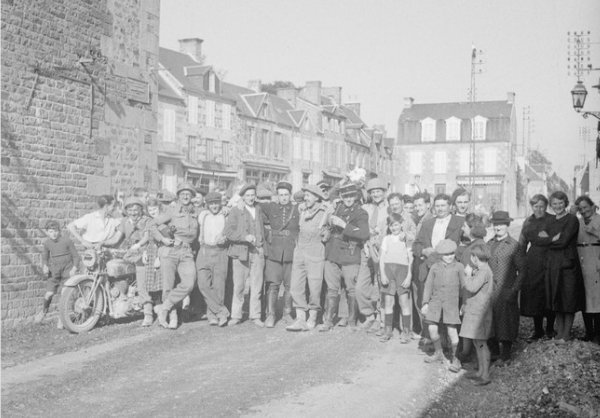
A group of inhabitants of Le Bény-Bocage greet a British soldier.
He had just knocked out a German tank.
The inhabitants of Le Bény-Bocage gave our troops a rousing welcome
when they arrived in the town. Here are some of them greeting British troops.
THE BRITISH ARMY IN NORTH-WEST EUROPE 1944-1945
B 8349 - B 8350
Creator: Sgt. Laing
Production date: 1944-08-01
https://www.iwm.org.uk/collections/item/object/205417534
La base d'IVM a numérisé 379 photos prises par le sgt Laing
en ligne ou en tableau
dont la B9589, un paysan et son âne, le 4 août 1944
https://www.iwm.org.uk/collections/item/object/205194511
Normandie 1944, voir aussi :
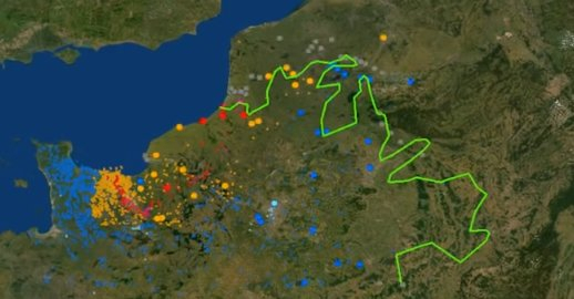
Carte des sabotages, mitraillages et bombardements aériens datés,
ciblant les trains et/ou les infrastructures de la #SNCF durant la 1ère quinzaine de juin 1944,
actions effectuées dans la cadre de l’opération #Overlord @FranceArchives
https://twitter.com/RiBoulard/status/1269220327088959489/photo/1
Normandie 1944, le bilan humain
http://www.unicaen.fr/mrsh/crhq/1944/Basse-Normandie.php
.
.


/http%3A%2F%2Fstorage.canalblog.com%2F04%2F03%2F161889%2F96234656_o.jpg)
/http%3A%2F%2Fstorage.canalblog.com%2F64%2F98%2F161889%2F99344442_o.jpg)
/https%3A%2F%2Fstorage.canalblog.com%2F90%2F87%2F161889%2F131105196_o.jpg)
/https%3A%2F%2Fstorage.canalblog.com%2F48%2F54%2F161889%2F132820728_o.jpg)
/https%3A%2F%2Fstorage.canalblog.com%2F02%2F17%2F161889%2F117651881_o.jpg)
/https%3A%2F%2Fstorage.canalblog.com%2F19%2F63%2F161889%2F117610470_o.jpg)